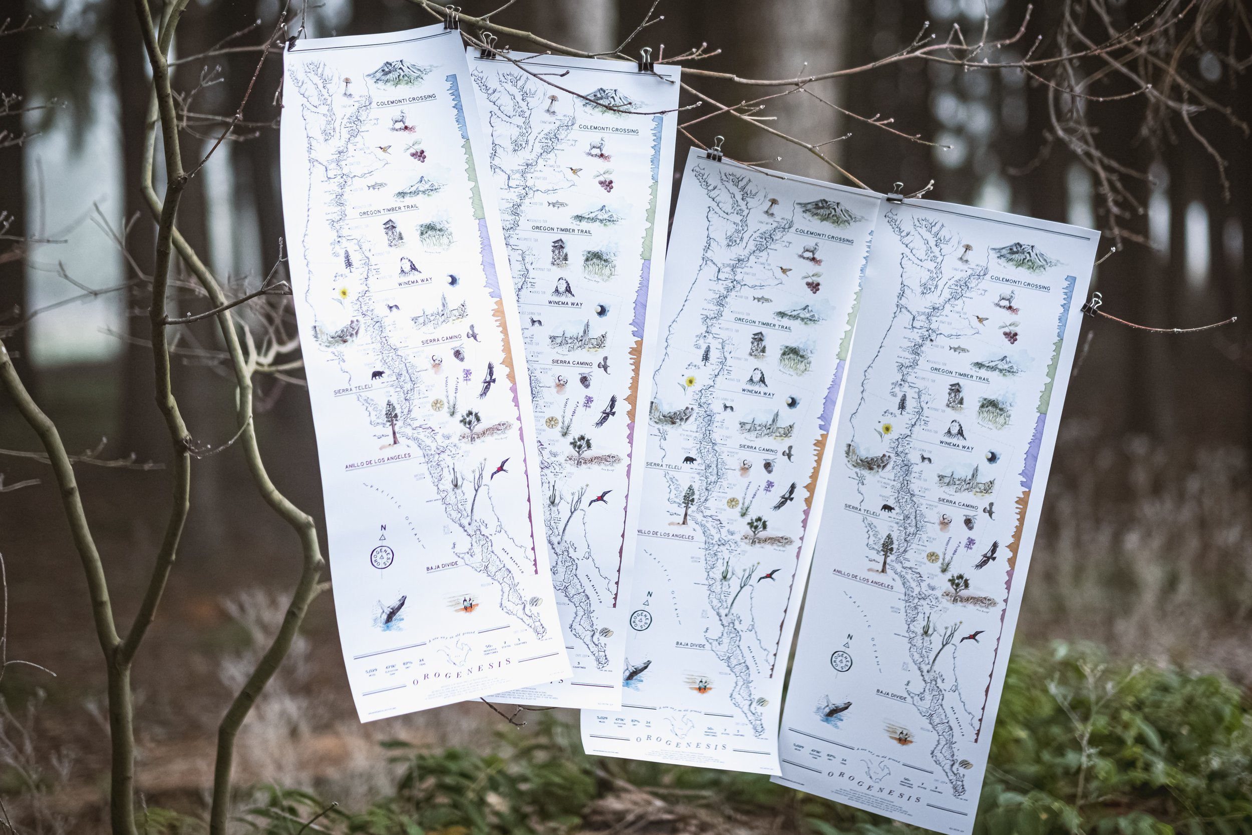
A glimpse at what’s to come—Claim your map now
“Can I ride Orogenesis yet?”
The answer is finally yes, at least parts of it—we’re ready to share Orogenesis with the world.
Gift a tax-deductible donation of $250
or more by December 31st, 2024 and get an 11x32” giclee archival map print from Alex Hotchin, a postcard set, and a sticker pack.
DONATE NOW ➜
One of our main accomplishments in 2024 has been the third major route refinement process since 2017. Now we have what our preferred alignment looks like if we could wave a magic wand and build a few dozen trail connectors. Through this refinement process we were able to replace roughly 150 miles of roads with singletrack, add alternate options for northbound and southbound riders, resolve dozens of unknown connections, and reduce the amount of gap solutions needed from 206 miles to 137 miles. These important improvements are thanks to the intrepid scouts who have been pedaling all over the western states in search of hidden backcountry gems. But let's not miss the forest for the trees, and focus on sharing the best sections that are currently rideable before we get to work building new trails.
Gift a tax-deductible donation of $100
or more by December 31st, 2024 and get a postcard set and a sticker pack.
DONATE NOW ➜
The Orogenesis route consists of seven chapters: Colemonti Crossing (Washington), Oregon Timber Trail, Winema Way (N. California), Sierra Camino (East Sierra), Sierra Teleli (West Sierra), Anillo de Los Ángeles (S. California), and the Baja Divide. Each of these chapters are 400-800 miles long, made up of 3-4 tiers. Oregon and Baja California are already complete, so we’re looking at the remaining five chapters and identifying the longest contiguous section in each of them to publish in 2025. In concert with these launches, we’re planning on coming to you and sharing photos and stories through a series of launch parties and group rides.
We expect thru riders of the full 5,000 miles will need to start at the Canadian border sometime in mid-July to avoid late melting snowpack, and make it to the southern Sierra by November when snow arrives again and the heat in Baja subsides. That said, most riders will be riding shorter sections that they can fit in a week or weekend. The sections we plan on launching in 2025 are aimed at those folks, 150-200 miles long, and start and end in gateway communities. A few of the tiers are fully ready to be shared, and others will be the best complete section without any gaps or major safety hazards.
Our tentative launch schedule is:
April: Colemonti Crossing, Loowit Tier Launch
May: Winema Way, Wokas Tier Launch
June: Sierra Camino, Lost Cannon Tier Launch
July: Sierra Teleli, Ahwahnee Tier Launch
August: Anillo de Los Ángeles, Ehmuu Tier Launch
We're timing these so you have a few months to plan before they melt out for the season and you head out on your trip. With each launch we'll share a route guide that covers seasonal constraints, trail difficulty, resupply logistics, and other helpful information. These early versions are sure to have some unexpected surprises (it’s an adventure, right?) and we’re looking for inaugural riders to provide feedback on trail condition, resupply points, water sources, GPS inaccuracies, and trip reports to share on our website. Make sure you’re on our mailing list to get these route guides and launch parties in your inbox.
We're really excited to share this with the world and see you out on the trail!
Donate today to claim your map. ➜
We worked with Alex Hotchin to design this beautiful map of the route, you may recognize her work from other bikepacking routes across the world. It is 11” x 32” and giclee printed on archival paper. We think it’ll look great on your wall or taped to your handlebars. Not intended for navigation. :)


